File:Terzijski Most.JPG

Original file (2,048 × 1,536 pixels, file size: 932 KB, MIME type: image/jpeg)
Summary
| Description |
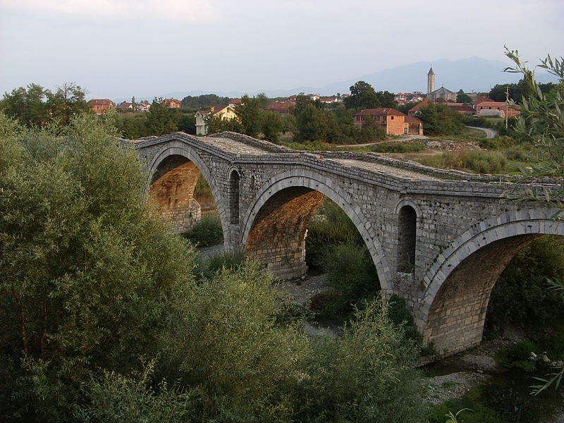
Deutsch: Die Terzijski-Brücke über den Erenik bei Gjakova, Kosovo.
English: Terzijski Bridge on Erenik River near Gjakova, Kosovo.
Shqip: Ura e Terzive në lumin Erenik afer Gjakovës, Kosovë. |
||
| Date | |||
| Source | Self-photographed | ||
| Author | Julian Nyča | ||
| Permission (Reusing this file) |
 Die kostenlose Weiternutzung dieses Bildes, insbesondere kommerzieller Natur, ist im Sinne der unten genannten Lizenz nur unter folgender Bedingung gestattet:
Durch die Bildnutzung erklären Sie sich mit den Lizenzbedingungen einverstanden. Im Falle eines Verstoßes gegen die Lizenzbedingungen erlöschen die Nutzungsrechte automatisch. Ich behalte mir vor, in diesem Fall ein nachträgliches Nutzungsentgelt in Rechnung zu stellen. Werden größere Versionen des Bildes oder eine Nutzung ohne Namensnennung gewünscht, bitte vorher hier anfragen!
 Bjezpłatne dalewužiwanje tutoho wobraza, wosebje komercielneho razu, je w zmysle podateje licency jenož pod slědowacym wuměnjenjom dowolene:
Z wužiwanjom wobraza akceptujeće licencowe wuměnjenja. W padźe zranjenja licencowych wuměnjenjow wužiwanske prawo awtomatisce zhubiće.
Weitere Bilder von Julian Nyča: alle – nur aus dem Album Kosovo – nur von 2008 Kontakt für Anfragen: julian.nyca (at) luzica.la
|
| Camera location | | View this and other nearby images on: OpenStreetMap |
|---|
Licensing

|
Permission is granted to copy, distribute and/or modify this document under the terms of the GNU Free Documentation License, Version 1.2 or any later version published by the Free Software Foundation; with no Invariant Sections, no Front-Cover Texts, and no Back-Cover Texts. A copy of the license is included in the section entitled GNU Free Documentation License. |
- You are free:
- to share – to copy, distribute and transmit the work
- to remix – to adapt the work
- Under the following conditions:
- attribution – You must give appropriate credit, provide a link to the license, and indicate if changes were made. You may do so in any reasonable manner, but not in any way that suggests the licensor endorses you or your use.
File history
Click on a date/time to view the file as it appeared at that time.
| Date/Time | Thumbnail | Dimensions | User | Comment | |
|---|---|---|---|---|---|
| current | 12:45, 4 July 2009 | | 2,048 × 1,536 (932 KB) | J budissin | == Beschreibung == {{Information |Description= {{de|Die alte Straßenbrücke über den Erenik bei Gjakova/Đakovica, Kosovo.}} {{en|Old road bridge on Erenik River near Gjakova/Đakovica, Kosovo.}} |Source=own photograp |
File usage
There are no pages that use this file.
Global file usage
The following other wikis use this file:
- Usage on azb.wikipedia.org
- Usage on ceb.wikipedia.org
- Usage on de.wikipedia.org
- Usage on dsb.wikipedia.org
- Usage on en.wikipedia.org
- Usage on en.wikivoyage.org
- Usage on es.wikipedia.org
- Usage on eu.wikipedia.org
- Usage on fi.wikipedia.org
- Usage on fr.wikipedia.org
- Usage on hr.wikipedia.org
- Usage on hsb.wikipedia.org
- Usage on hu.wikipedia.org
- Usage on hy.wikipedia.org
- Usage on id.wikipedia.org
- Usage on ja.wikipedia.org
- Usage on ka.wikipedia.org
- Usage on ro.wikipedia.org
- Usage on ru.wikipedia.org
- Usage on sh.wikipedia.org
- Usage on sq.wikipedia.org
- Usage on sr.wikipedia.org
- Usage on tr.wikipedia.org
- Usage on uk.wikipedia.org
- Usage on www.wikidata.org